| |
|||||||
| |
|||||||
| |
|||||||
|
Imotski
valley is
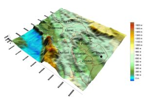
situated in between Podi
plato, 600-700 meters high on the north side and Osoje ravine on the
southern side. It is 33.3 km long running from northwest toward
southeast. 17.5 km of it belongs to Imotski county.
The valley is widest between Runović and
Vinjani, 5 km and the narrowest between Kamen Most and Glavina, 1
km. The Dalmatian part of the valley is 45 km² area that consists
of Upper and Lower valleys. The Upper valley, 22,5 km², has
Proložac field, Proložac
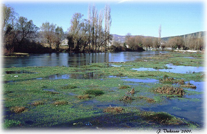
retention with Krenice, Proložac, and
Provalija lakes, Naklo, Lug, and Mujića fields, and Brižine.
The Lower valley consists of Pasike, Dila, Krenice, Ljupčevica,
Vinjani field, Otok, Zalug, and Zmijavci
and Runovići fields. The Imotski
county has 23,5 km² of the Lower valley while Herzegovina has 50
km². Herzegovina part of the valley is called Bekija.
There are many ravines, platoes, and hills
south of the valley: Mračaj (534m),
Podosoje (842), Vardište (693), Osoje
(868), Vilinjak (859), Orljaca (909), Sidoc (849), Sridnja gora (556)
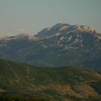
and of course mountain Biokovo (1762). On the north side are
platoes Podi (680) and Vinjani (717).
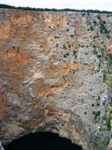
In addition to Imotski valley there are two other fields: Studenci and Aržano fields. Studenci field is rather small, 1 km² in area, 3 km long and 0.4 km wide. It is divided in two parts: Large (Veliko) and Small (Malo) fields. Aržano field is also very small with the area of 1.4 km². There are many caves and sinkholes in the county, most of them unexplored and located near Biokovo mountain. Well known ones are Jovna near Krstatice, Gradinice, Lozovac, and Ljubovička near Ljubović in Biokovo. Explored sinkholes are Golubnjača (15 m deep), Ivanić (50-100), and Procipska which depth has not been measured yet near Krstatice, and Gozdenjača on the boundary of Slivno and Krstatice. Unexplored sinkholes are Golubinka near Osoje, Vitrenjača, Čavčanjača, i Brsčanova on the boundary of Slivno and Krstatice, Mijoravača in Župa, and Vodena and Ćapinova in upper Podbablje. The terrain is tectonically very unstable, placing the Imotski town region in VIII earthquake zone under Mercalli scale. There were several major earthquakes in years 1923, 1937, and in 1942. The climate is influenced by Mediterranean
climate in the summer and by the continental mountains climate during
the rest of the year. The summers are very dry and warm, while
the winters bring very little snow. The sky is mostly bright
during a year with more than 230 sunny days. Rainy season is
mostly in November and February producing 1300 mm of rain per
year. The most important winds are the cold northern wind called
"bura" with sometimes very strong gusts of more that 70 miles per hour
and east-southern wind called "jugo" that brings humidity and rain from
the Adriatic sea. The tree vegetation is mostly deciduous:
linden, acacia, white poplar, elm. Dalmatian pine is a
predominant coniferous tree in the county. There are also firs on
Biokovo. The Imotski County water masses belong to
Vrljika Imotski drainage system that is one of the thirty-four
Croatianrainage regions. It consists of Imotski valley and a few
smaller karst
fields, 602 km2 in total. The eastern side of the Imotski
Valley, called Bekija belongs to Bosnia and Herzegovina. Further east there is Jezerine or Dva Oka
(Two Eyes) as they are better known that are seasonal springs for
Vrljika river. The north "eye" is 42 meters in diameter, while the
south "eye" is 44 meters. The depth of the north "eye" reaches 12.7
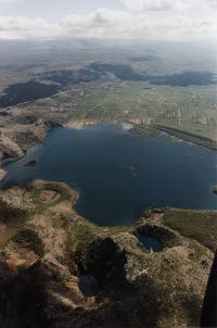
meters. Near village Glavina there is seasonal Jažva lake
which is dry in summer time.
|
|||||||
